Murihiku Māori Tours Collection
This collection brings together images of places experienced on a new whānau venture — Murihiku Māori Tours — landscapes shaped by deep history, cultural significance, and ongoing connection to whenua and moana. Photographed across Southland and the southern coastline, these images reflect moments visitors often pause to absorb, rather than simply pass through.
Some photographs appear in other collections on this site, particularly in the Bluff /Motupōhue section, but here they are gathered through the lens of place-based storytelling, offering an opportunity to revisit locations encountered on the tour and to take home a visual reminder of that experience.
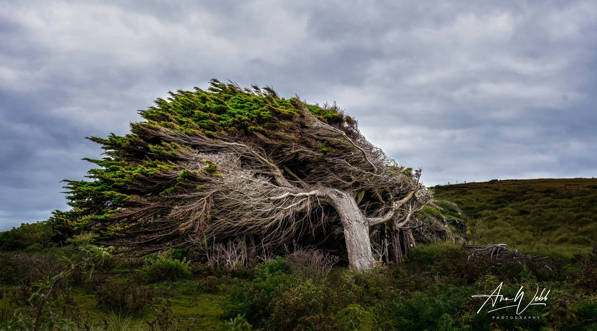
A line of macrocarpa conifer trees is dramatically twisted and shaped by the strong southerly winds that buffet the shores of Ocean Beach on the edge of Foveaux Strait in Bluff.
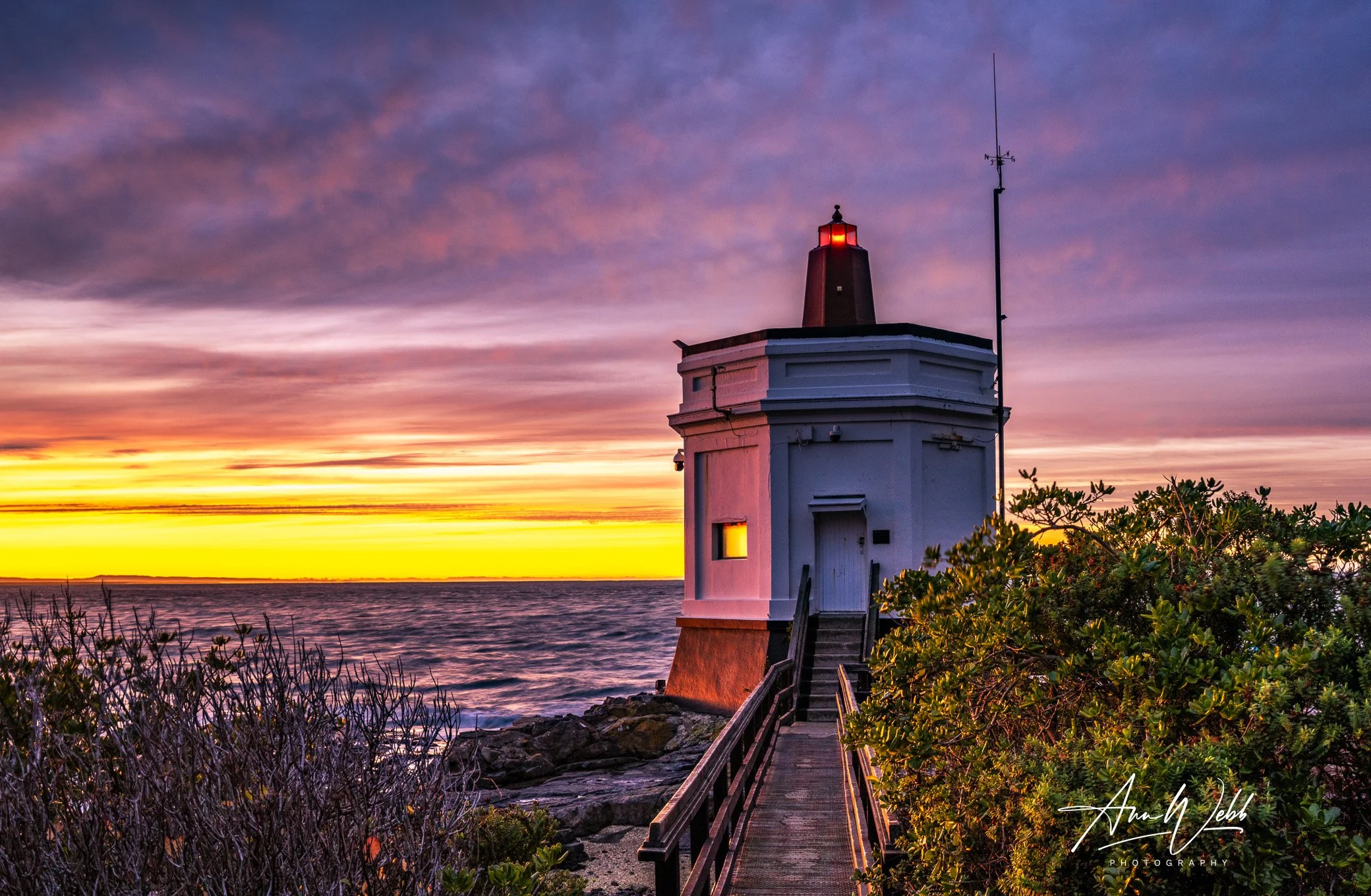
The Bluff Pilot Station at sunrise, its guiding light still glowing as the first light of day spreads across Foveaux Strait. Soft golds and deep purples illuminate the southern sky, highlighting the rugged beauty of Aotearoa’s coastline at dawn.
This image captures a moment of quiet anticipation at the gateway to the south. A striking statement piece well suited to coastal, contemporary, or heritage-inspired spaces.
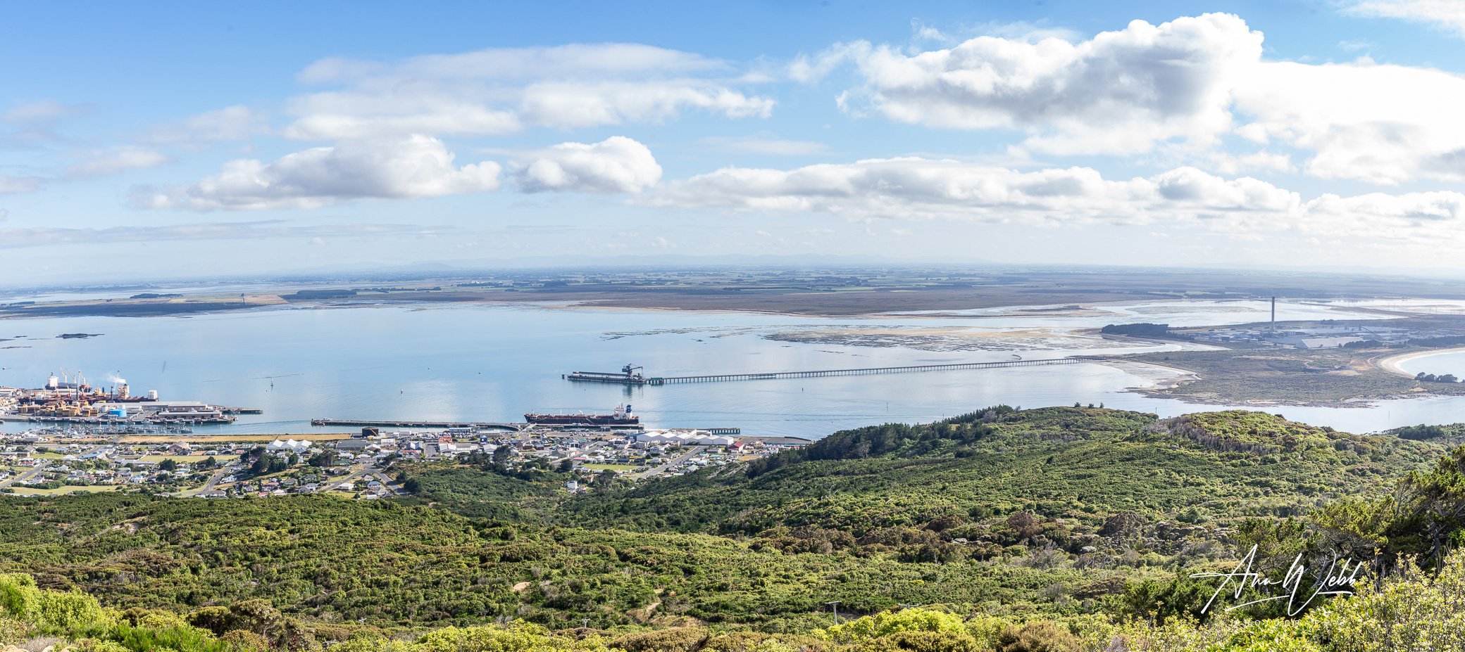
A panoramic view over Bluff Harbour, photographed from Bluff Hill. This image shows the sweep of the coastline, the working port, and the surrounding wetlands that define this southern landscape.

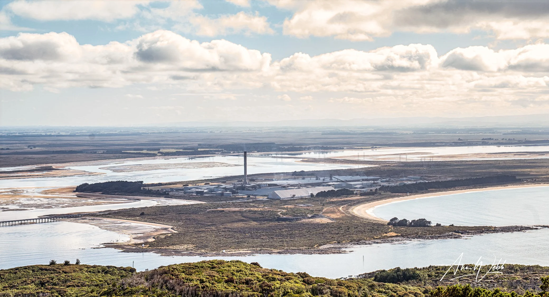
Photographed from Bluff Hill, this image looks across the coastline toward Tiwai Point and the Tiwai Aluminium Smelter, with shifting light over land and water that characterises this part of Murihiku. The area also holds cultural significance for Māori, with a rich archaeological history, and is the home to the Awarua-Waituna Wetlands.
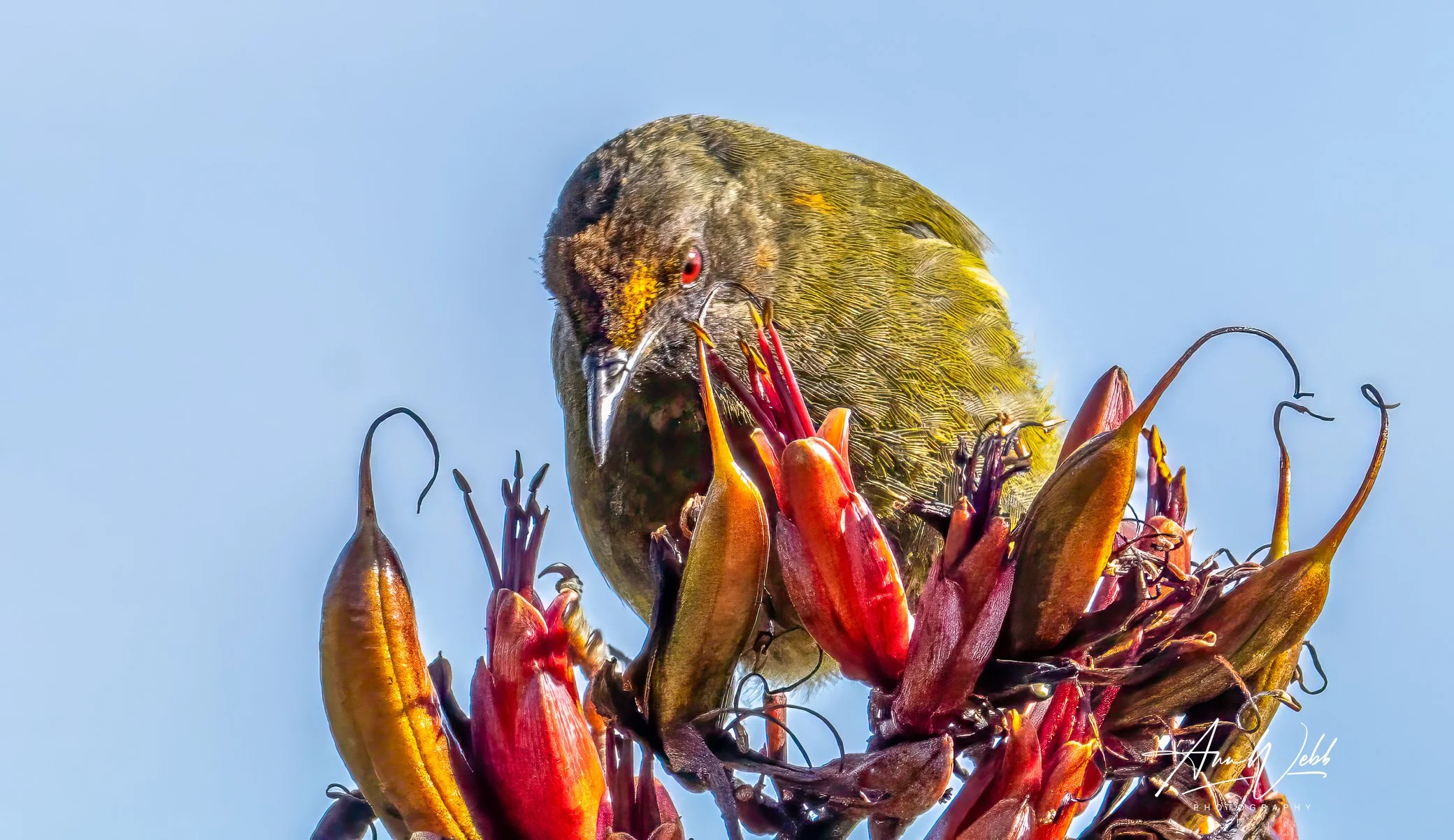
A korimako (bellbird) feeding among native flax on Motupōhue (Bluff Hill). A close, intimate image capturing one of Aotearoa’s distinctive native birds in its natural environment.
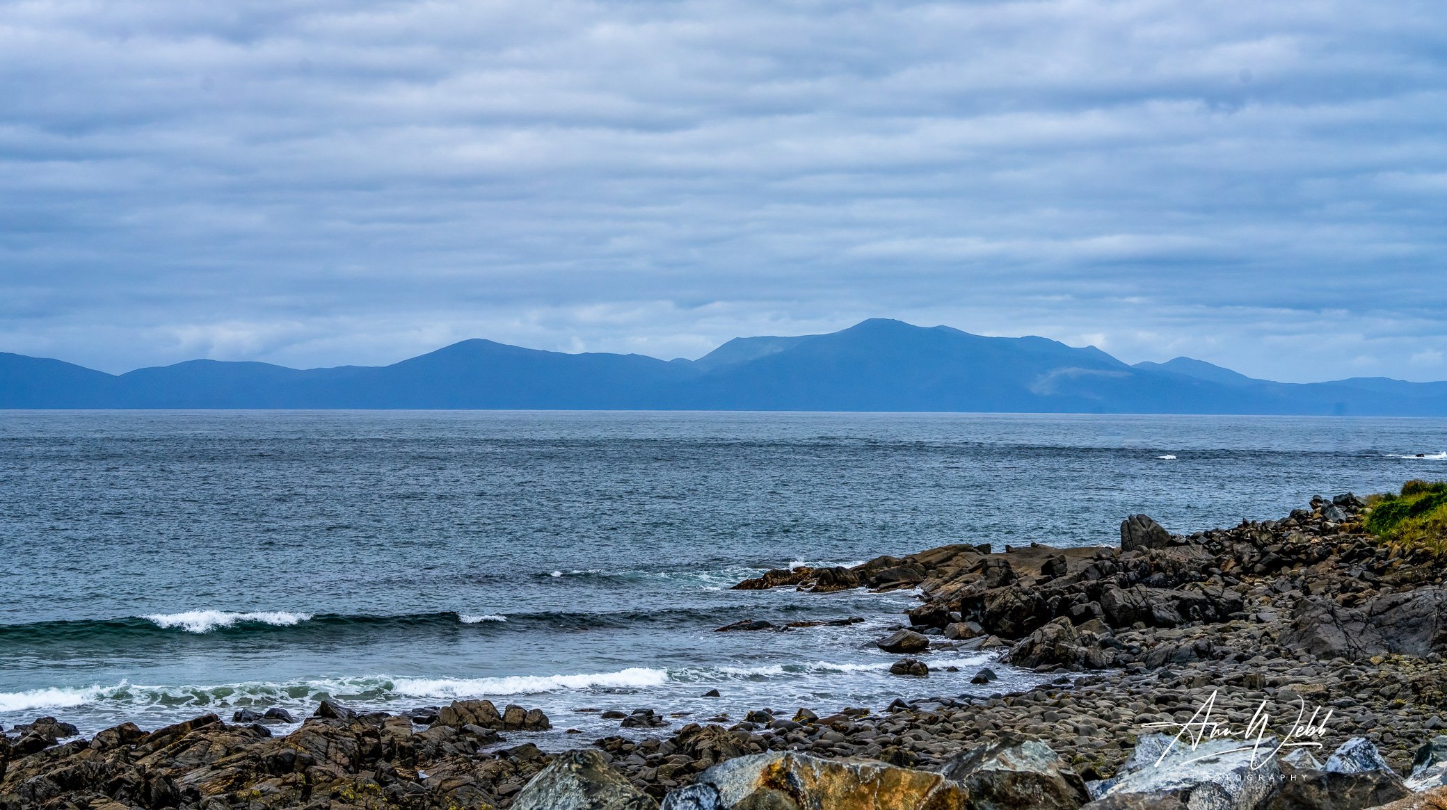
A landscape view of the wild Foveaux Strait from Ocean beach in Bluff, NZ, showing Rakiura/Stewart Island, with its highest peak, Hananui (Mt Anglem) in the background.

Bluff Lighthouse, also known as Stirling Point Pilot Station, is situated in a place of geographical significance, marking the southern beginning of State Highway 1, which stretches from Bluff/Motupōhue to Cape Reinga in the far north of New Zealand to Bluff.
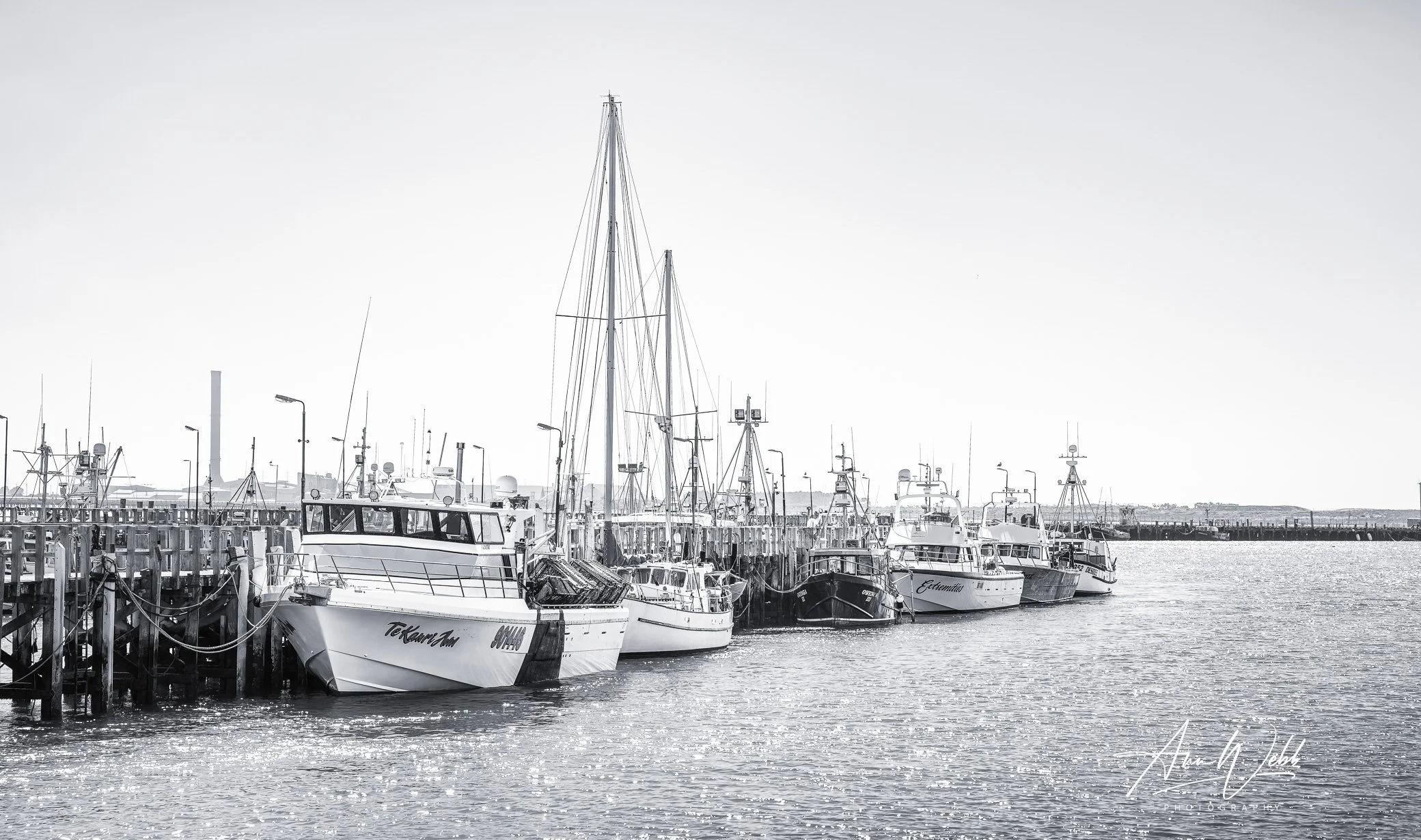
Local boats moored in Bluff Harbour, photographed in calm conditions. An understated image of everyday life on the water at the southern end of the South Island.

Bluff Hill Motupōhue provides visitors to the area with spectacular views over Foveaux Strait and the Southland Plains.